Map / Trips / Zones
Unifying live tracking and historical trip review into one coherent surface
The Map page is the most-visited surface in MyGeotab — but live vehicle tracking and historical trip replay lived in two separate experiences with incompatible controls. This is an active redesign sprint focused on collapsing that split into a single, contextual view that serves both use cases without compromise.
Context & Constraints
Fleet operators use the Map constantly — to see where vehicles are right now, to replay trips that happened yesterday, and to check zone compliance over a date range. These are three variations of the same question: "Where were my vehicles, and when?" But in MyGeotab, they lived in two separate destinations with different controls, different map states, and different interaction models. Operators who wanted to move between live and historical views had to leave the page entirely and rebuild their context from scratch.
Two chromes, one concept
Live tracking and historical trip review shared the same underlying map but required operators to navigate to separate pages — breaking spatial context every time.
Incompatible control models
The Live map and Trips page had diverged enough that the same actions worked differently in each context — creating confusion for operators who switched between them regularly.
Zones treated separately
Zone compliance — a core use case for fleet managers — was a third destination, further fragmenting what operators experienced as a single workflow.
The most-visited page carries the highest risk
Any change to the Map surface affects the widest possible user base — requiring a measured approach that preserves familiar patterns while resolving the structural split.
Design direction
One surface, two temporal modes
Live and historical aren't separate use cases — they're the same question asked at different times. The redesign treats them as a single surface with a time control, not two distinct pages.
Context is the product
When operators switch from live to historical, they want to keep the same vehicles, the same map region, the same mental context. The redesign preserves spatial and filter state across the mode switch.
Zones belong on the map
Zone boundaries are geographic — they live on the map by definition. Pulling zone compliance into the map surface (as an overlay layer) removes an unnecessary page hop and makes the data immediately visual.
Approach
A unified map surface with contextual controls — live tracking, trip replay, and zone compliance in one place.
Time control layer
A persistent temporal control at the top of the map surface lets operators slide between now and any point in history — without leaving the page or losing their filter state.
Unified vehicle/driver selector
A single entity selector works across both live and historical modes — eliminating the need to re-filter when switching between tracking and trip review.
Zone overlay integration
Zone boundaries surface as a toggleable layer on the unified map — allowing fleet managers to see route history and zone compliance together in a single visual.
Progressive control depth
Operators get a clean default state with the controls they need most. Advanced filters (exception types, speed overlays, stop duration) are a step deeper — accessible but not in the way.
Role & Ownership
Design Lead
- Leading the active redesign sprint — from problem framing and research synthesis through to interaction design and prototype iteration.
- Driving alignment between product, engineering, and fleet operations stakeholders on the unified surface model.
- Designing the time control interaction — the core mechanic that makes live-to-historical switching feel continuous rather than disruptive.
- Coordinating with the Next Gen MyG navigation work to ensure the Map redesign fits coherently within the Hub & Spoke model.
More work at Geotab
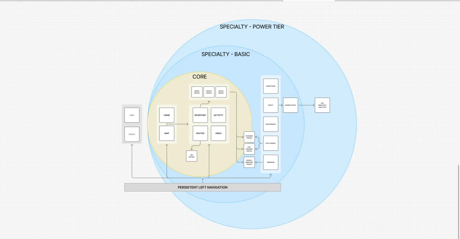
Next Gen MyG
Platform-wide IA redesign — Hub & Spoke navigation that cut new-user churn by 71% across 500K+ operators.
View case study →
Platform Paper Cuts
Identifying and eliminating high-frequency usability issues — shifting platform culture toward fixing fundamentals safely and continuously.
View case study →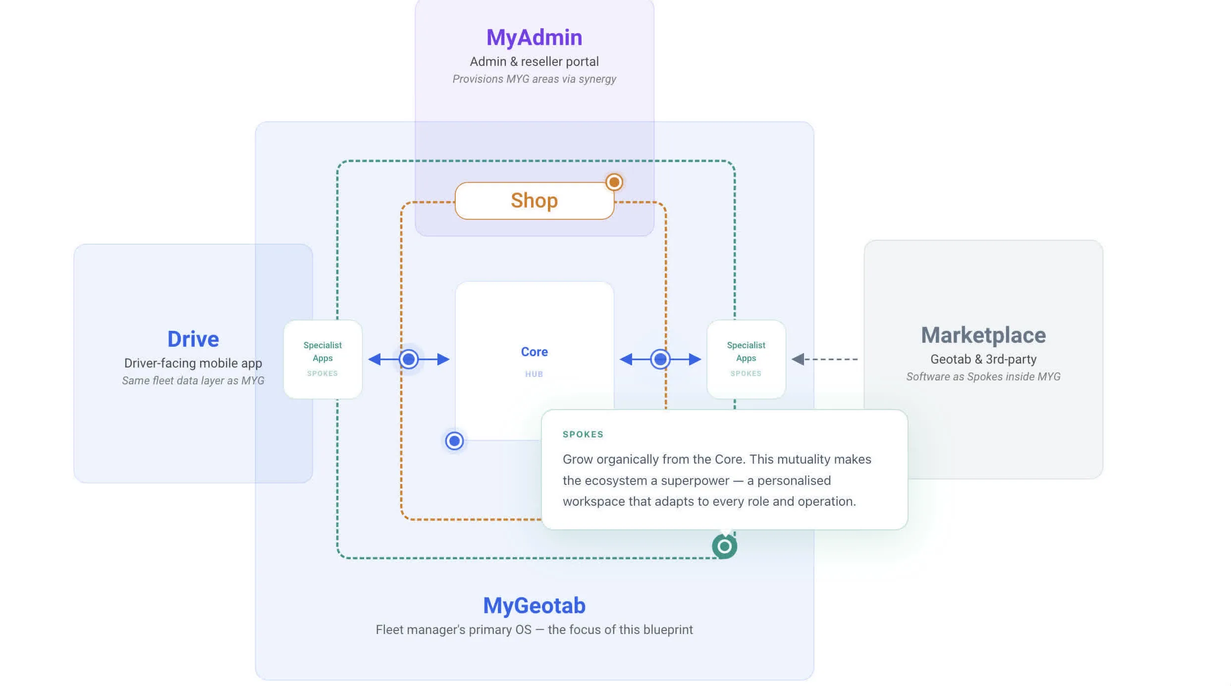
Dashboard & Shared Patterns
Defining shared patterns for high-traffic surfaces — aligning interaction models across teams and reducing rework.
View case study →